

- << Back to Blogs index
Geomax for Archaeologists
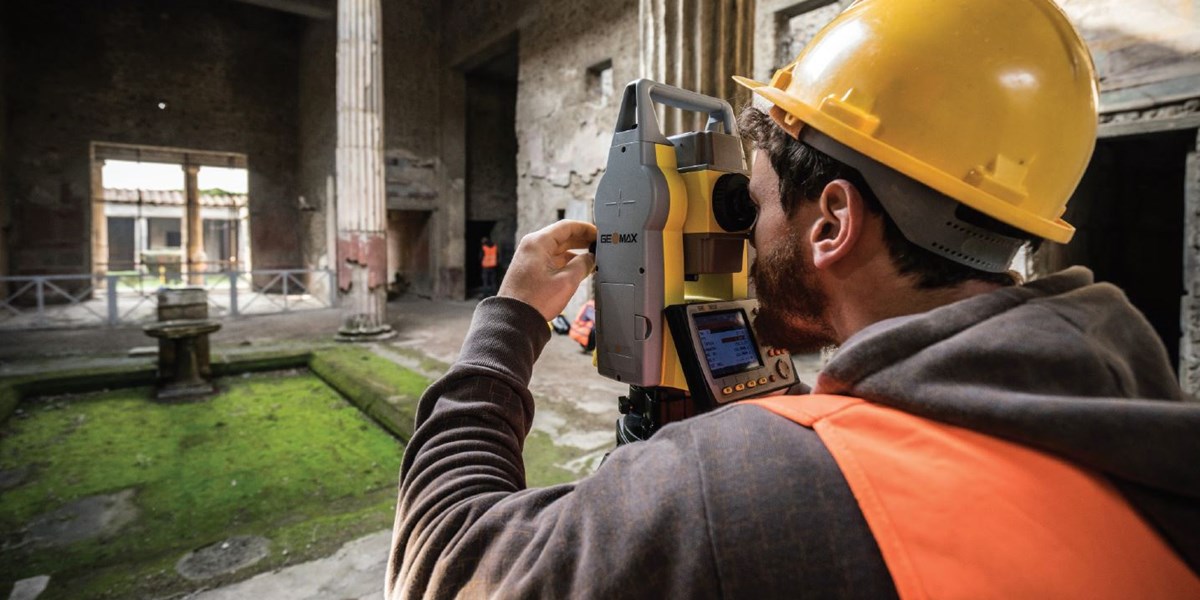
I recently read Maps for Time Travelers by Mark D. McCoy, all about how technology is revolutionising the way archaeologists study and reconstruct humanity’s distant past. It’s a great book, full of insight, and it got me thinking how we at Surveytech can best support our clients in that field, especially as Geomax specialist partners. Geomax has a strong track record when it comes to archaeology; its equipment has been used on some of the world’s most famous sites, such as the Zoom35 in Pompeii (pictured). But with recent innovations in both software and hardware it has become even more attractive for those seeking to discover the mysteries of the past. Here’s why:
Ease of Use
The X-pad Android app is designed to be intuitive and all its processes are quick to learn for anyone familiar with using a phone or tablet. Drawings are easily visualised in CAD view so archaeologists can see the progression of their survey. Archaeologists often have a basic knowledge of survey techniques but we are happy to help them develop those skills either in person or using the great online resources available here.
Customisable GIS coding
Geographical Information System or GIS is essentially the creation of an interactive map and is one of the fundamental exercises of modern archaeology. Codes can be uploaded en masse to X-Pad or imputed in the field and made to look, store and quantify whatever you want.
Google integration
Google maps can be easily overlaid onto surveys and documents can be stored in google drive so that they’re accessible to teams that aren’t on site. If they want to take team integration to the next level, they can even use X-Live, which updates the data on controllers and the office in real time, seamlessly.
Value for money
Both for hire and sale, Geomax represents cutting edge technology at competitive prices. But being the cheapest is no use if the equipment isn’t reliable. As it shares the cutting edge research and development team from Leica Geosystems, you can be sure that your instruments will be accurate and dependable.
A full range
It’s important to have the right tool for the job so Geomax has you covered. From the urban dig where you need to check first for live cables with an EziCAT i750xf to the x-Pad Fusion software that allows you to consolidate all the information from various different sources - total stations, GPS, point clouds, photogrammetry and drone data.
McCoy’s contention is that archaeologists don’t find things, they find things out and at Surveytech we always try to provide the best advice and training we can to help our clients in that mission.


Stay up to date
Sign up now to receive the latest style emails, sale alerts and more.