

- << Back to Blogs index
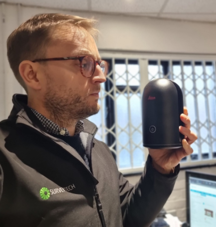
What Is Laser Scanning?
Laser scanning, also known as LIDAR (Light Detection And Ranging), is a method of making a lot of rapid distance measurements to create a georeferenced 3D picture, known as a pointcloud. If that sounds a bit complicated, think of each of those points just as one single measurement, just as you would make with a total station- each with its own coordinate registering its position in space, except there are potentially millions of them as the laser scanner uses a spinning mirror to make an enormous number of measurements in a short amount of time. You can see exactly what I mean in my video below of the RTC360 laser scanner in action:
Who Would Use a Laser Scanner?
Laser scanners have applications in many different industries, really anywhere that measurements of something need to be taken quickly and accurately. In film/television and video games, they can be used to replicate a space digitally that has been scanned. In construction and survey, the pointclouds can be used to create a dxf floorplan of a building, or just supplied so that any dimension can be quickly and accurately ascertained.In facilities management, pointcloud data can be enriched with tags showing where work needs to be undertaken along with pictures of the item in question. This practice is also hugely useful in Building Survey or heritage, where the current state of an asset can be accurately recorded. In archaeology, the ability to completely document a site in a non-intrusive manner is extremely useful. You can see this in action at ‘Egypt’s sistine chapel where they successfully used the Leica BLK360 to scan the area despite the challenges of the location:
What Features Are Important On a Laser Scanner?
Accuracy
What level of accuracy are you working to? Each scanner will list both the 3D point accuracy as well as how much ‘noise’ you will have in your data. You should also remember that you can improve your accuracy by employing targets that have been measured with a total station, creating a control network. If you’re looking for speed and accuracy, we recommend the Leica RTC360.
Speed
Each scan takes a certain amount of time to complete and this will vary with the scanner and change depending on your settings. If you want lower point density, the scan will take less time, and this is easily adjusted on Leica’s Cyclone Field App. Tripod-based scanners will provide greater accuracy but each set-up takes time so if you need to cover a large area and accuracy isn’t as important, why not use a mobile scanner? We can supply an excellent range of these from GeoSLAM as well as Leica’s BLK2GO. With the possibility of mounting the GeoSLAM Horizon on a drone you can cover even more ground quickly whilst still producing great datasets. Here you can see the ZEB Revo RT in action, with real-time creation of the pointcloud so you can be sure you’ve captured everything.
Ease Of Use
Laser scanners create potentially enormous datasets that can end up as a confusing mess if the software is difficult to navigate or if the scanner isn’t user friendly. Thankfully with GeoSLAM as you can see in the video above, it’s really easy to go from walking around to a fully registered pointcloud and onto whatever deliverable you require. With Leica’s Cyclone Field app you can pre-register your pointcloud, making sure that all your set-ups line up in the field, before tightening things up with extra links on the Register360 desktop programme.
Cost
There’s not really such a thing as a cheap laser scanner in real terms, but the Leica BLK360 comes closest as it was deliberately created to democratise the technology and that means a more affordable price point than some of the eye-watering sums that had previously been the only option in the laser scanner market. But if you don’t want the significant outlay or would just like to try out a couple of options before you buy, then hiring is definitely the best option.
Other Features
Do you need an imaging laser scanner? If you’re sending off your pointclouds to someone else to work with, having it in real colour with panoramas for reference can be essential. Need thermal imaging? The BLK360 has that capability already built-in. Do you want to attach it to Spot the robot dog? Leica have already been working on this and we can even supply a protective saddle for your mechanoid hound. However weird and wonderful your surveying task might be, we will always try to offer you the best technical advice - just tell us your requirements.
For laser scanners and indeed all surveying equipment, Surveytech can offer competitive rates and personal service so get in touch today!


Stay up to date
Sign up now to receive the latest style emails, sale alerts and more.